|
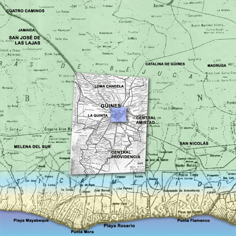
These maps were originally put together from three
sources. The map of Güines itself comes from
the map of the town in at tejeratrans.com site; street names, the name and location of buildings,
parks, etc., are being provided primarily by C. Mariano
Domínguez with lots of help
from our compatriots. The information for the
surrounding area comes from a 1943 map provided by
Allen Morrison (for more information, visit his site
“The
Tramways of Cuba”).
site; street names, the name and location of buildings,
parks, etc., are being provided primarily by C. Mariano
Domínguez with lots of help
from our compatriots. The information for the
surrounding area comes from a 1943 map provided by
Allen Morrison (for more information, visit his site
“The
Tramways of Cuba”).
Of course, all mistakes are mine, and not to be attributed
to the sources, least of all Mariano who in addition
to contributing all the invaluable information about
Güines, also spends a great deal of time and
effort catching and correcting my mistakes (and I
keep him plenty busy).
|